We take you on an unforgettable tour around Iceland. Not only the nature took our breath away, but also the unstable weather and the friendly inhabitants. Everything about our Iceland holiday, the most beautiful sights, facts and camping possibilities can be found in this blog post.
Day 1
The day of arrival. Our flight left at 2 pm directly from Düsseldorf to Keflavík Airport. We picked up our VW Caddy and started our two-week trip all around Iceland.
Campsite: Out of Reykjavík at a forest entrance (free of charge)
Day 2
Via Þingvallavegur, 47km, 42min
Þingvellir National Park is part of the Golden Circle and creates real Game of Thrones vibes. The place has an important meaning, not only for tourists, but also for the history of Iceland. “Thing” means people and “vellir” means plain. Thus, the national park is also called “Plain of the People’s Assembly”. Also, on site you can find the Thingvellir church and the remains of old stone houses.
We hiked to a small waterfall called Öxarárfoss. The walk there was totally interesting and fun, even with some rain.
An incredible first impression! Since day 1 we knew this trip was going to be very special!
Via Route 52, 102 km, 1h 45min
Hraunfossar is truly breathtaking. The many small waterfalls pour out of the black lava field, which is probably around 1000 years old. Its name means that all the hundreds of waterfalls arise from the lava.
Via Snæfellsnesvegur, 155km, 1h 50min
The reason to visit Búðir is the small black church in the middle of the countryside – Búðir Black Church. The cloudy sky and the green-brown lawn around the church made the picture just perfect. This is exactly why the small, minimalist church is such a popular photo motif for photographers.
Via Útnesvegur, 21km, 18min
The view over the cliffs is incredible. Many tourists come to Arnarstapi to see the Bárður Snæfellsáss statue. This embodies one of Iceland’s many legends, which among other things is about the volcano Snæfellsjökull. Bárður is said to have been one of the first settlers in the area and to have troll blood in his veins. He disappeared into Snæfellsjökull, where he is said to still sit and guard his treasures.
Via Útnesvegur & Snæfellsnesvegur, 54km, 53min
We parked next to a large meadow with many Icelandic ponies and ended the evening with picture editing and a good book.
Campsite: Parking lot for Grundarfoss (free of charge)
Day 3
The day started with a drone flight to Grundarfoss, a 70-metre-high waterfall in the west of Iceland.
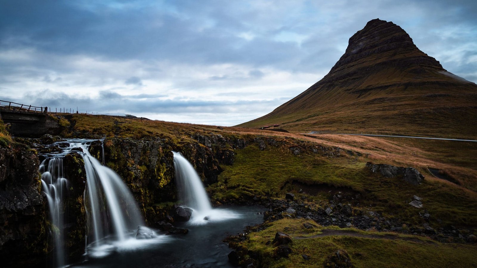
Afterwards we drove to Kirkjufellfoss, which is not far away. It is 16-metres-high and consists of two steps. It is located 1.5 km South of the mountain that gives the waterfall its name, which is 463-metres-high, and 2.5 km west of the village of Grundarfjörður on the north coast of the Snæfellsnes peninsula. Mount Kirjkufell is also the setting in the series Game of Thrones.
The waterfall is not as big as the other well-known waterfalls in Iceland, but it is still very beautiful because of its composition.
Due to the weather (typically Icelandic of course) it was very slippery on site. Nevertheless, we strolled halfway around the waterfall and back the same way.
Via Snæfellsnesvegur, 336km, 4h 35min
Off to the Westfjords! Garðar BA 64 is the oldest steel shipwreck in Iceland, built in Norway in 1912. It originally had both sails and steam engines and was intended for whaling in the South Atlantic. It is a full 30 metres long and 6 metres wide and the actual name of the ship was Globe IV, but after a few changes of ownership it was called Garðar. In 1981 it was towed to the coast of the Skápadalur valley in Patreksfjörður. It has been rusting there ever since.
Such old stories are really interesting! You cannot miss the ship on your way and you can even get very close to it. You can also look inside a little.
Even with a cloudy sky, the photos will be unique, because the atmosphere that you feel on spot is reflected.
Via Örlysgshafnarvegur & Rauðasandsvegur, 15km, 19min
Rauðisandur is a white sandy beach in the Southeast. But it is not just any white beach, it is the only one in Iceland. On the way there, seemingly endless roads wind around the mighty mountains stretching towards the ocean. What really takes your breath away are the endless expanses. The beach is unbelievably long and the countless shells colour the sand red, brown, yellow and orange in the sunlight.
Via Barðastrandavegur, 102km, 1h 40min
You can see the huge waterfall from afar! Dynjandi is simply stunning and takes your breath away. Camping is no longer allowed on site, so you will need to allow enough time to see the waterfall. The waterfall is 100-metres-high and twice as wide at the bottom as at the top. There are several smaller waterfalls below Dynjandi, but their names are not pronounceable at all.
WOW! Dynjandi is an absolute highlight! You can stand right in front of it – the feeling is breathtaking. Once you turn around 180 degrees, you have a fantastic view over endless expanses.
Campsite: Near Dynjandi at a hotel (fee required).
Day 4
Off to the north! Hvítserkur is a 15-metre-high basalt rock in the middle of the sea. According to Icelandic legend, this rock was once a troll that was petrified because he was said to have thrown stones at a monastery. However, many tourists see it more as a drinking dragon, which is why it is also called “The Drinking Dragon”. To get to the lower beach, you have to climb down the small cliff. Due to the many tourists, a small path has been created there, but it is still very steep and slippery.
Attention! Especially during rainy weather, the ascent and descent is really very slippery. I got a huge bruise on site because I slipped along the path.
Via Þjóðvegur, 205km, 2h 40min
On to the next town! Akureyri is a relatively large town in the North of Iceland and it is located at the foot of the Eyjafjördur fjord. In the centre of town is Akureyri Church, which was built in the 1940s and features stained glass windows depicting scenes from Iceland’s religious history.
We only ate and stayed overnight there, but you can also admire contemporary works by Icelandic and international artists in Akureyri’s art museum, for example.
Campsite: Campsite in Akureyri (fee required)
Day 5
Via Þjóðvegur (toll!), 35km, 30min
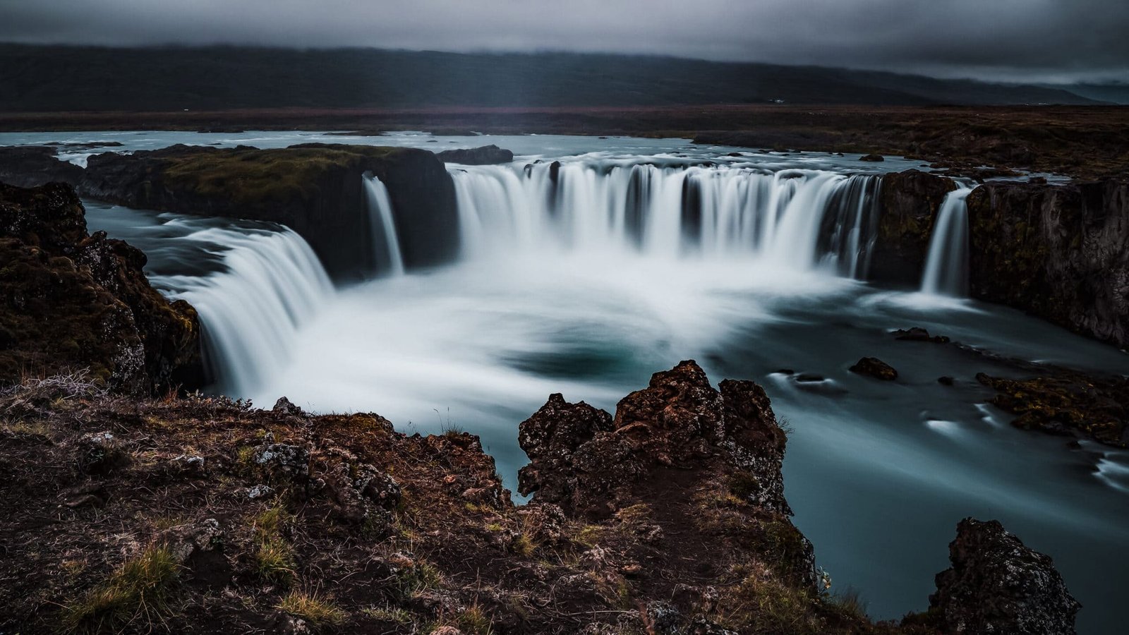
The next waterfall! Goðafoss is one of the most famous waterfalls in Iceland and about 11-metres-high. Its name means “waterfall of the gods” because, according to legend, the law speaker Þorgeir Ljósvetningagoði Þorkelsson threw pagan images of gods into the waterfall after Christianity was accepted as the state religion. In 2020, Goðafoss was declared a nature reserve.
The waterfall is really beautiful! Its unusual composition makes it very special and you can view and photograph it from different perspectives.
Via Aðaldalsvegur & Norðausturvegur, 47km, 37min
Húsavík is a small fishing town and part of the Diamond Circle. The small town may look familiar to some, as it was popularized by the film “Eurovision Song Contest: The Story of Fire Saga”, which was produced by Netflix. It is possible to book whale watching tours locally.
Of course, we also booked a whale tour! This is highly recommended and with North Sailing you have the option to choose an environmentally conscious tour.
Via Krísilvegur, 56km, 47min
Lake Mývatn is also part of the Diamond Circle and is located in the area of the municipality of Skútustaðir in the Northeast of Iceland in the area of the Krafla volcano system. The lake is located about 50 kilometres South of the coastal town of Húsavík and is approximately 37 square kilometres in size. The lake got its name because of its large mosquito population, which increases especially in summer.
Campsite: Campsite near Lake Mývatn (fee required)
Day 6
Via Þjóðvegur, 14km, 18min
Grjótagjá Cave is a cave with a small lake and is truly magical. This lake is underground and heated due to geothermal activity. In the past you could swim in the lake without any problems, but nowadays it is forbidden. This cave may look familiar to many, as it was the setting for John Snow and Ygritte’s love scene in the third season of Game of Thrones.
This cave is definitely magical! It smells a bit like sulphur, but the atmosphere will make you forget the smell. Grjótagjá Cave is a bit narrow, so you should pay attention to how many visitors have already disappeared into the cave. It also has two different entrances and thus offers different perspectives.
Via Þjóðvegur, 14km, 16min
The Krafla Lava Fields is a large volcanic system about 100 km long in the North of Iceland. This is known for its bubbling mudholes and lots of smoke. There is also not only a turquoise crater, but also an explosion crater.
The centre is a central volcano, under which there is a magma chamber at a depth of about 3 km. This volcano is 200,000 years old.
However, the weather changed abruptly, which is of course typical for Iceland. On site, only one of us admired the lava field, while the other waited in our warm camper. Three guesses who was waiting in the warm!
Via Þjóðvegur & Hólsfjallavegur, 70km, 1h 10min
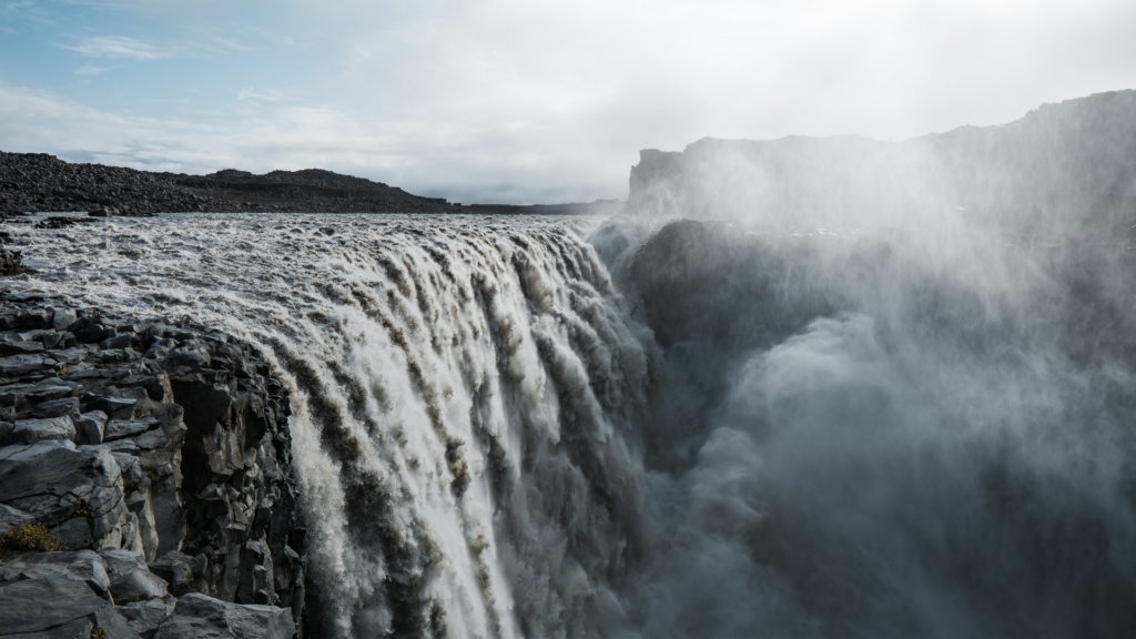
On to Dettifoss! The most powerful waterfall in Northeast Iceland is not only incredibly powerful, but also intimidating! The water masses that fall into the gorge are breathtaking. It is the second most powerful waterfall in Europe and around 100-metres-high. The view into the Jökulsárgljúfur canyon is absolutely intimidating and fascinating at the same time.
There is no barrier, which means you can get very close to Dettifoss. But please be careful. The rocks can be extremely slippery even in sunny weather due to the spray, so always take care!
Via Þjóðvegur, 160km, 2h 5min
Campsite: Site next to a bridge near Fljótsdalshérað (free of charge)

Day 7
Via Seyðisfjarðarvegur, 26km, 27min
In Seyðisfjörður you can have a really nice relaxing day, for example in one of the local restaurants. The small town is known for the famous Rainbow Street. At the end of the street is a small, light blue church, which makes this place an absolutely photogenic spot.
The little town is just adorable! Especially the view of the light blue church at the end of the rainbow road is gorgeous! We enjoyed a delicious lunch in a small restaurant.
You should not expect a big town, because Seyðisfjörður is only very very small. According to research, the village had only about 700 inhabitants when we went there.
Via Þjóðvegur, 283km, 4h
An absolute highlight was the glacier lake Jökulsárlón and the nearby Diamond Beach. The lake is famous for the floating icebergs that detach from the glacier Breiðamerkurjökull. With a depth of 284 metres, it is also the deepest lake in Iceland. If you look closely, you may also see some small seals among the icebergs. Diamond Beach is divided into two sections, one to the right and one to the left of the bridge. There, the icebergs are partially washed up and it looks as if the beach is covered with ice crystals – the diamonds.
Are we dreaming? What a fantastic place it is! Seeing little seals swimming among the icebergs was just the cherry on the cake!
Campsite: A campsite between Diamond Beach and the Skeiðará Bridge Monument (fee required).
Day 8
Especially at sunrise, Diamond Beach is something very special. It was simply magical to see the sun’s rays breaking in the crystals.
Via Þjóðvegur, 57km, 43min
In November 1996, a huge volcanic eruption caused a massive glacial flood. Huge blocks of ice were dragged along by the floodwaters, some weighing up to 2,000 tons. The flow of water was so enormous that the Gígjukvísl Bridge, which led across the Skeiðarársandur sand flats, was washed away and the Skeiðará Bridge was badly damaged. A twisted metal sleeve covered in graffiti is all that remains of the Skeiðará Bridge. Today, this sight is called the Skeiðará Bridge Monument.
It may be hard to imagine, but the bridge wreck is incredibly wobbly. Getting up there will be less difficult than trying to get further up the wreck, especially if it is also slightly windy.
Via Þjóðvegur & Skaftafellsvegur, 6km, 6min
Svartifoss is a waterfall in Skaftafell National Park. It is also called the “Black Waterfall” because of the colour of the basalt columns surrounding it. Below Svartifoss there are still the remains of a small power station. From the car park you walk for about half an hour, which offers beautiful views.
Via Þjóðvegur, 58km, 43min
Foss á Síðu is an 82-metre-high waterfall in the South of Iceland. The houses below the waterfall are called Foss. When the water is blown away due to strong winds, this phenomenon is called a “flying waterfall” by the Icelandic inhabitants.
A quick look through the window was enough for us, but the waterfall is really cool!
Via Þjóðvegur, 21km, 23min
Fjaðrárgljúfur Canyon was just another of our highlights. The canyon is up to 100 metres deep in some sections and it is a protected area. It was formed due to flowing water coming from the glaciers. The river that flows through the gorge is called Fjaðrá.
One highlight follows the next! It was a bit windy, but the view was breathtaking. We were even lucky with the weather for once, so we had an even more fantastic view of the gorge, the vastness and a beautiful waterfall!
Via Þjóðvegur, 69km, 53min
Vík í Mýrdal is a small village located by the sea in the South of Iceland. The village has less than 1,000 inhabitants and is situated in the shadow of the Mýrdalsjökull glacier.
Campsite: Vík Camping (fee required)

Day 9
Via Þjóðvegur and Reynishverfisvegur, 11km, 13min
Reynisdrangar are basalt sea stacks beneath Mount Reynisfjall. You can see them from the Black Sand Beach called Reynisfjara. This is probably one of the most dangerous beaches in Iceland, as the water masses are washed onto the beach with tremendous force. Reynisfjara is treacherous and dangerous, even deadly in some circumstances.
According to legend, the basalt rocks were formed when two trolls unsuccessfully pulled a ship ashore and became rock needles at dawn.
When we were on site, we had great weather at first and the ocean looked peaceful. However, the weather changed abruptly and it started raining and storming. Suddenly, the ocean also looked threatening and we could understand the warnings all too well.
The basalt columns on the beach are also a well-known photo motif, but you should be a little careful when climbing them.
Via Reynishverfisvegur & Þjóðvegur & Dyrhólavegur, 20km, 22min
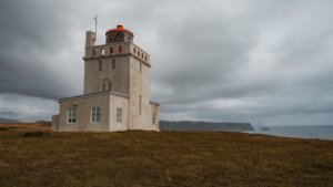
The Dyrhólaey lighthouse marks the most Southern point of Iceland with its white light that illuminates every 10 seconds. Breathtaking views are offered in all directions. If you look North, you will see the glacier Mýrdalsjökull, while to the East is Reynisdrangar.
(P.S.: After that, the Sólheimasandur plane wreck would actually be next on the route. However, the hike there is about 7 kilometres long and you should be back at the car park before dusk, so we planned this spot for the next day).
Via Þjóðvegur, 28km, 30min
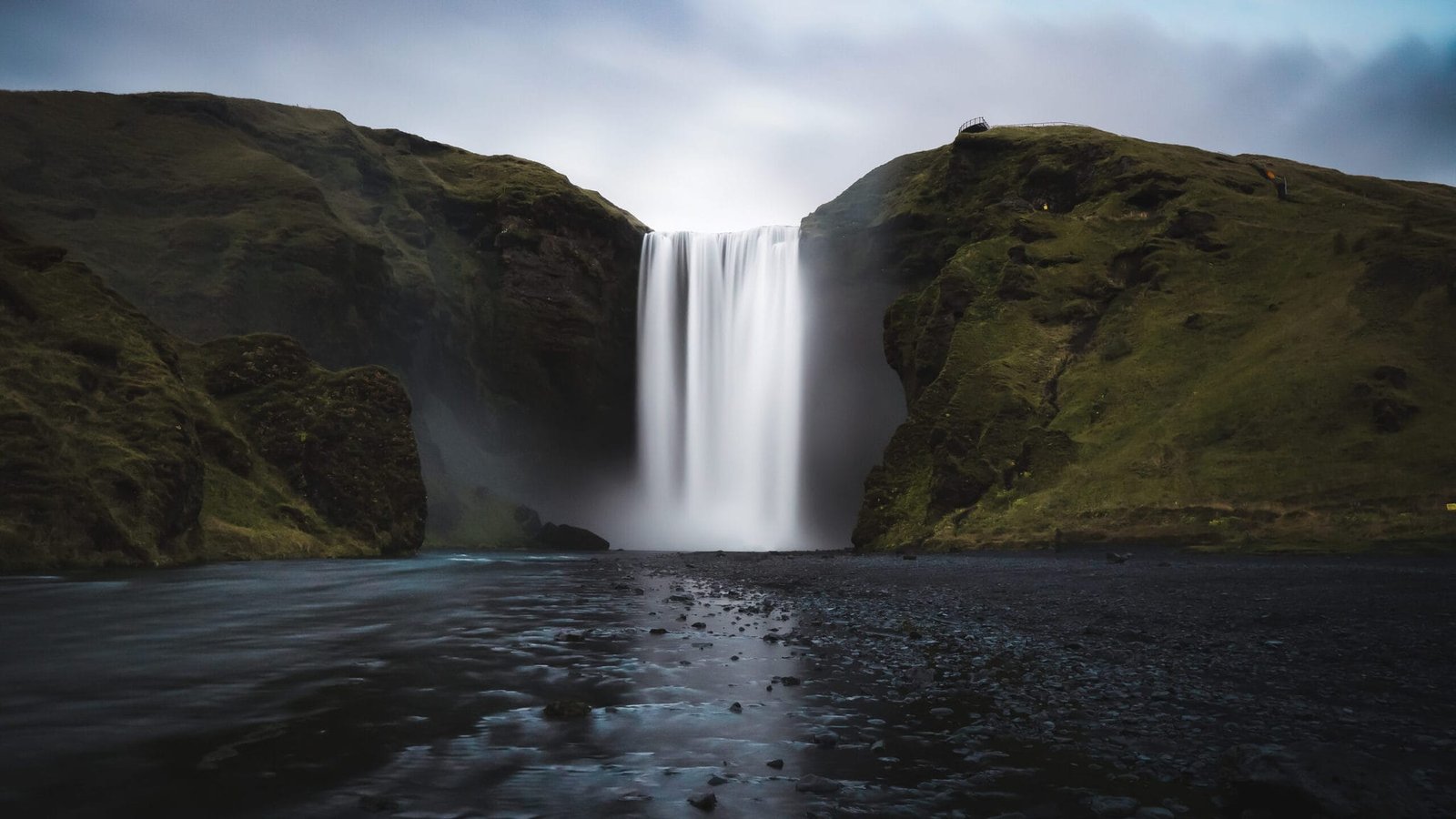
Probably one of the most famous waterfalls in all of Iceland is Skógafoss, which drops 60 metres. To the right of it is a path that you can walk all the way to the top for a sweeping view over Þórsmörk to Landmannalaugar.According to a legend, the first Viking settler in the area buried a treasure in a cave behind Skógafoss. Some time later a boy found the chest, but he only got hold of the handle before the box disappeared. The ring from this treasure chest is kept in the Skógasafn Museum.
This is exactly what a waterfall looks like in a picture book. Skógafoss is simply beautiful! It was even worth getting a proper shower when approaching the waterfall.
Campsite: Skógafoss Camping (fee required)
Day 10
Via Þjóðvegur, 9km, 10min
The Sólheimasandur plane wreck is about 3.5 kilometres from the car park. This track is not asphalted and the weather can make it quite difficult to get there. You therefore also have the option of taking the extra bus. During the crash in 1973, all occupants remained unharmed, which is difficult to believe at first glance. The black sand created an atmosphere like on another planet.
The hike is really not spectacular, because you basically see nothing far and wide. For this reason, the hike is not entirely without danger, as many hikers get lost on site in bad weather. Once you arrive at the wreck, however, the atmosphere changes and you think you are on another planet. The vastness suddenly no longer seems scary, but breathtaking.

Via Þjóðvegur, 36km, 27min
We continue with two beautiful waterfalls: Seljalandsfoss and then Gljúfrabúi. Seljalandsfoss is 66-metres-high and lies below the Eyjafjallajökull glacier. You can walk behind the waterfall and look out through the veils of water onto the vast land.If you walk along the rock wall to the West, there are several small waterfalls and at the end there is Gljúfrabúi, which means “gorge dweller”. It lives up to this name as it is partly in a half-open cave. The gorge is accessible and 40-metres-high.
Ok WOW. Seljalandsfoss is really great, but Gljúfrabúi really did it for us. It is completely different from the previous and following waterfalls – it is simply unique!
Via Dímonarvegur, 18km, 20min
Merkjárfoss is also located in the South of Iceland, it is about 45-metres-high and rises from the river Merkjá. This waterfall is often called Gluggafoss because “gluggi” means “window” in Icelandic and the water flows as if through open windows. The waterfall changes slightly every generation because the mountain is very soft. In 1974, the 1100th anniversary of Iceland’s settlement was celebrated on the grassy plain below the waterfall.
We looked for the waterfall for a long time because we saw it on pictures in our research. If you cannot find it on Maps, you should try both names: Merkjárfoss and also Gluggafoss.
Campsite: Campsite near Hjálparfoss (fee required)
Day 11
Via Þjóðvegur & Þjórsárdalsvegur, 101km, 1h 17min
Hjálparfoss is located in the South of Iceland and with its height of 9 metres it is rather one of the smaller waterfalls. However, it features something very special – it is divided into two parts. The Hjálparfoss drops over two basalt columns in two cascades, which unite again in the downfall. Its name means “auxiliary waterfall” because of the area of Hjálp.
Hjálparfoss is actually less well-known than many other waterfalls in Iceland, but nevertheless well visited. We did not expect that buses even stop on site to bring tourists by. The viewing platform is not that big, so you should think about the best time to admire the waterfall.
Via Þjórsárdalsvegur & Háifoss, 20km, 30min
You can reach Háifoss via two routes. From the Stöng farm you can take a long hike of five to six hours. The trail is not always easy to follow and you have to walk through a riverbed in parts, so there is an alternative. There is a car park above the waterfall, which is 122-metres-high and thus the third largest waterfall in Iceland. The view from above into the gorge is breathtaking.
Gosh, it can get quite windy up there! Keep your stuff close to your body and definitely do not use an umbrella! The gorge, however, is really incredible, almost picturesque. We could hardly believe our eyes when we saw the waterfalls tumbling down this picturesque gorge.
Via Þjórsárdalsvegur & Biskupstungnabraut/Route 35, 97km, 1h 30min
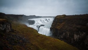
The golden waterfall, Gullfoss, is one of Iceland’s most famous sights and also part of the Golden Circle. It consists of two steps, which are 11 and 21 metres high. From the second step, the water of the river Hvítá tumbles into a gorge. This is 2.5 kilometres long and 70 metres deep. Gullfoss is a nature reserve.
Via Route 35, 10km, 9min
Campsite: Campsite at Geysir (fee required)
Day 12
Geyser is an absolute tourist attraction in Iceland and is part of the Golden Circle, just like Gullfoss. The two most famous geysers in the area are the Great Geyser and the Strokkur. The Great Geyser is probably the most famous in the world and also the eponym of the other geysers. In 2000, it reached an eruption height of 122 metres, after having been very inactive for several years. Today it is again very inactive, which makes it all the more mysterious. Stokkur, on the other hand, is the most active geyser in Iceland and erupts approximately every four to ten minutes. It often reaches a height of 15 to 20 metres.
SNOW! IN SEPTEMBER! We could not believe it when the tiny snowflakes began to fall from the sky. In combination with the hot springs and geysers, this situation was just unique!
By the way, please do not throw money into the springs. It really does not do you any good and you only pollute the environment!
Via Route 35 & Biskupstungnabraut, 46km, 35min
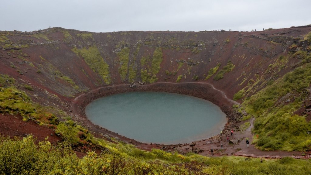
The Kerið Crater in Iceland is definitely a highlight along the Golden Circle. This volcanic crater offers a beautiful walk around both the top and the bottom of the crater. That crater is estimated to be 6,500 years old and the lake depth varies between 7 and 17 metres. The blue water contrasted with the red earth presents a beautiful colour spectacle.
The hike around the crater with the great view and the descent to the crater lake are very worthwhile.
There is a fee to visit the crater, but it is very cheap compared to other sights. A few nice pictures are quickly taken and you can continue your journey after a short time.
Via Suðurlandsvegur & Route 49, 68km, 55min
Campsite: Parking Lot at the BSI bus terminal in Reykjavík
Day 13 & Day 14
Reykjavík is located on the coast of Iceland and it is the capital and largest city of the country. Locally, there is not only a variety of food, but also many small cafés and places of interest.
For one thing, there is the Hallgrímskirkja in Reykjavík, the Icelandic state church. This is not only beautiful from the outside, but also breathtaking from the inside. From October to April, it is open from 9 am to 5 pm, from May to September even from 9 am to 9 pm.
Bæjarins Betzu Pylur is your go-to place for typical Icelandic street food. The hot dogs on site are really sensational. Traditionally, you order your hot dog “eina með öllu”, i.e., one with everything.
Secondly, in the north of Iceland, by the sea, you will find the Sólfar, a sun ship in which many see a stylised Viking ship. This was designed by Jón Gunnar Árnason (1931-1989) and it is Iceland’s most famous photo motif. It symbolises the promise of a new, undiscovered land.
Probably the most beautiful thing you can see in Iceland are the northern lights. In summer, you will have no chance of seeing the dancing lights, as there are far too many hours of sunshine at this time of year. In winter, your chances are even higher. The important thing is that the sky is not overcast and you are beyond the city lights.
We really thought we had seen it all. Iceland is gorgeous, no question about it. But then we saw the green lights dancing above our heads. Tears welled up in our eyes. We had never seen anything so beautiful before.
Campsite: Parking Lot between Reykjavík and Keflavík (free of charge)

Day 15
5:30 a.m. – Drop off camper van
6:00 am – Airport
7:45 am – Departure
Goodbye, Iceland! You were stunning and we will definitely be back soon!


